|
Miscellaneous Places, Part I , Blisworth, Northamptonshire, UK. All pictures are presented at relatively low resolution. There will be hundreds of pictures on this site - there is an economic limit to the webspace available. The point of this presentation is that you can see for yourself the extent of the collection and return later as the collection expands - as it surely will. Any interest in copies of a picture at a higher resolution (ie. clarity) should be directed through contacts given in the Blisworth "Round and About" parish council publication or using the comment form on the home page. In some cases the pictures are not available due to copyright restrictions. However, permission has been obtained, where possible, to include them here. Printed below each image is the photographer's name, if known. |
|
|
Back to INDEX page This is Part I Part II |
|
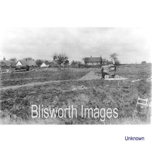 |
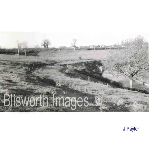
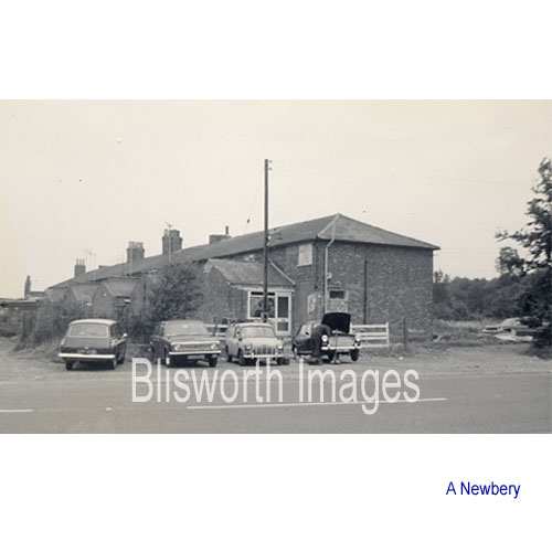
21-01 This is the allotment field in c. 1958 being prepared for building by the Acme Company - the street created in the early 1960's being Greenside (see the aerial photograph). The left-hand white gable is No. 20 Stoke Road. |
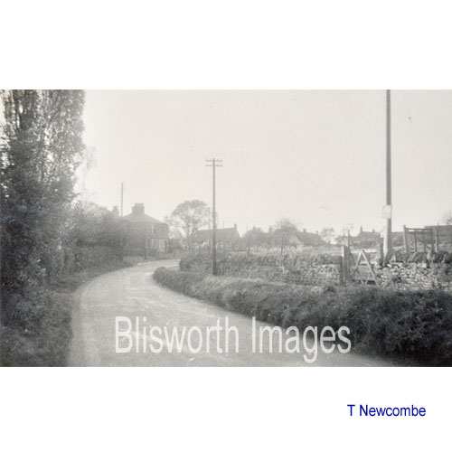 |
21-15 A view along the Stoke Road before the building of Greenside and its associated Stoke Road houses. |
 |
21-02 The Green, Stoke Road. The allotments are located behind the twin cottages. Opposite the cottages is the deep excavation for the canal. In times before the excavation, there was a green there which extended down to the brook.
|
 |
21-03 Visible in this 1925 picture are the chimneys of the Westley Buildings, the ironstone bridge and a slantwise line beyond the bridge which coincides with the sewage pipe from the Westley Buildings.
|
 |
21-04 When the sun is low, the profile of the Blisworth Hill railway is clear to see. It comes very close to the bank above the canal at this point in the Park Slopes and there is not room for a two-way set of rails - a possible reason for this is provided in the Tunnel Construction.
|
 |
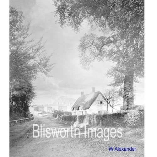
21-05 Twin Cottages at The Green, Stoke Road. "The Green" once extended across the space used by the canal cutting - see the tunnel construction account. |
 |
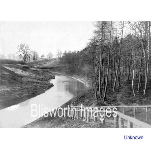
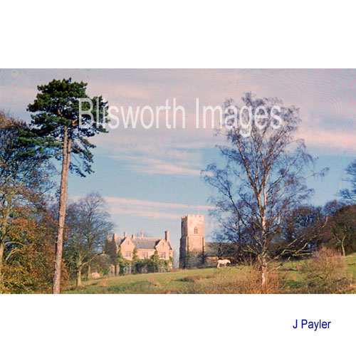
21-06 Church and Rectory from the canal bank. |
 |
21-07 |
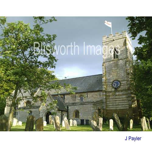 |
21-08 Church of St John the Baptist, High Street. |
 |
21-09 This picture is taken to the left of the picture no. 16-00 and shows more clearly the rear of a row of cottages facing the old elm tree. It was Plot 41 in the Grafton Sale catalogue. The house with the more gentle pitch of the roof to the left is Elmtree House - it was converted to a slate roof at a very early date - see picture no. 13-01 - and probably used Welsh slate imported to Blisworth Wharf. The two dormer windows are still present.
|
 |
21-10 Jasmine Cottage, High Street. |
.JPG) |
21-11
Grafton Villa - that is Dr Knott and housekeeper at the doorway, c. 1900 |
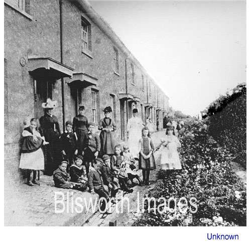 |
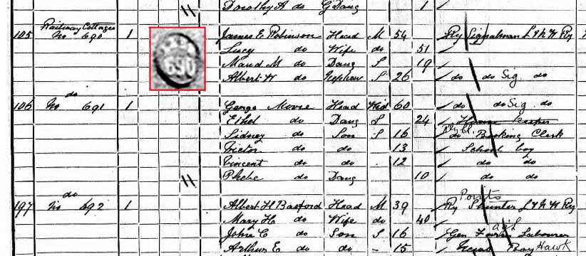
21-12 The Railway Cottages.
Built by LNWR and thought to be part financed by J. Westley. The date is c. 1900. The woman
third from the left is Mrs Louisa Jeffcott.
Her husband was head-porter at the station and was self-taught on the
violin (exceptional in those days). Mrs Louisa would hide his
violin between mattresses just before he was expecting to play at
'dubious' 1860s dances.
Note many children have large dolls, note also the fine canopies and the circular plaques for each door. The nearest appears to show LNWR 690 and the first house listed in the 1901 census is No. 690. A Mr Robinson, Signalman, was there then - this photograph was probably earlier. This view is thought to be on the Northampton side of the row with the camera facing the station.
|
 |
21-12a The railway cottages in c. 1975. Incidently, the 1838 survey made by Grafton coincided with when the first small station was placed at track level on the embankment and the present station was not built. This area was classified as 'spoil ground' and named by the railway company as "The Brick Ground". Built near the road here was a block of three houses. their purpose can be assumed to be to house builders or railway staff in the very early days. |
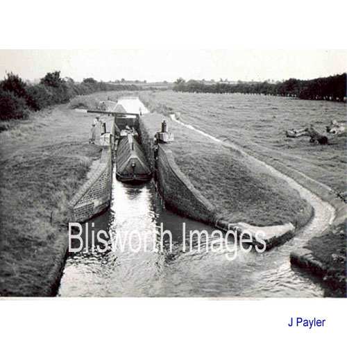 |
21-13 Northampton Arm - the boat is carrying grain for Whitworth's - date c. 1960. |
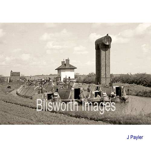 |
21-13a At Northampton Arm top-lock there used to stand a brick column on which was mounted a water tank - pictured here in 1958. It was filled by pump from a well. The water was provided for boatmen to refill their on board domestic water tanks. The little white lock-gate house still stands, near the Rothersthorpe road canal bridge.
|
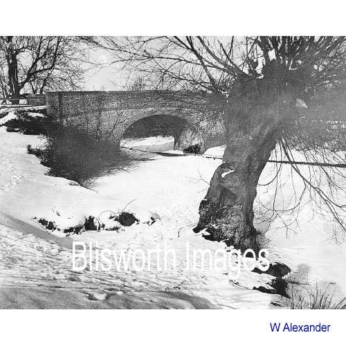 |
21-14 Candle Bridge. |
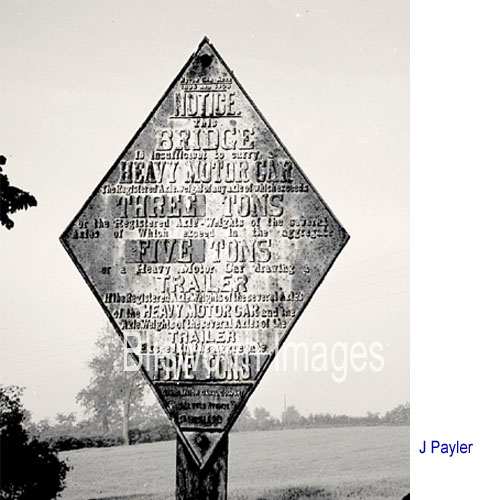 |
21-14a The diamond shaped
sign which warned drivers of load restrictions at Candle Bridge.
Picture here in 1960 - they have now all been replaced with much simpler
signs "Weak bridge - 5 tonnes per axle max). The original
verbosity must have assumed a driver was prepared to stop to read it.
|
 |
|